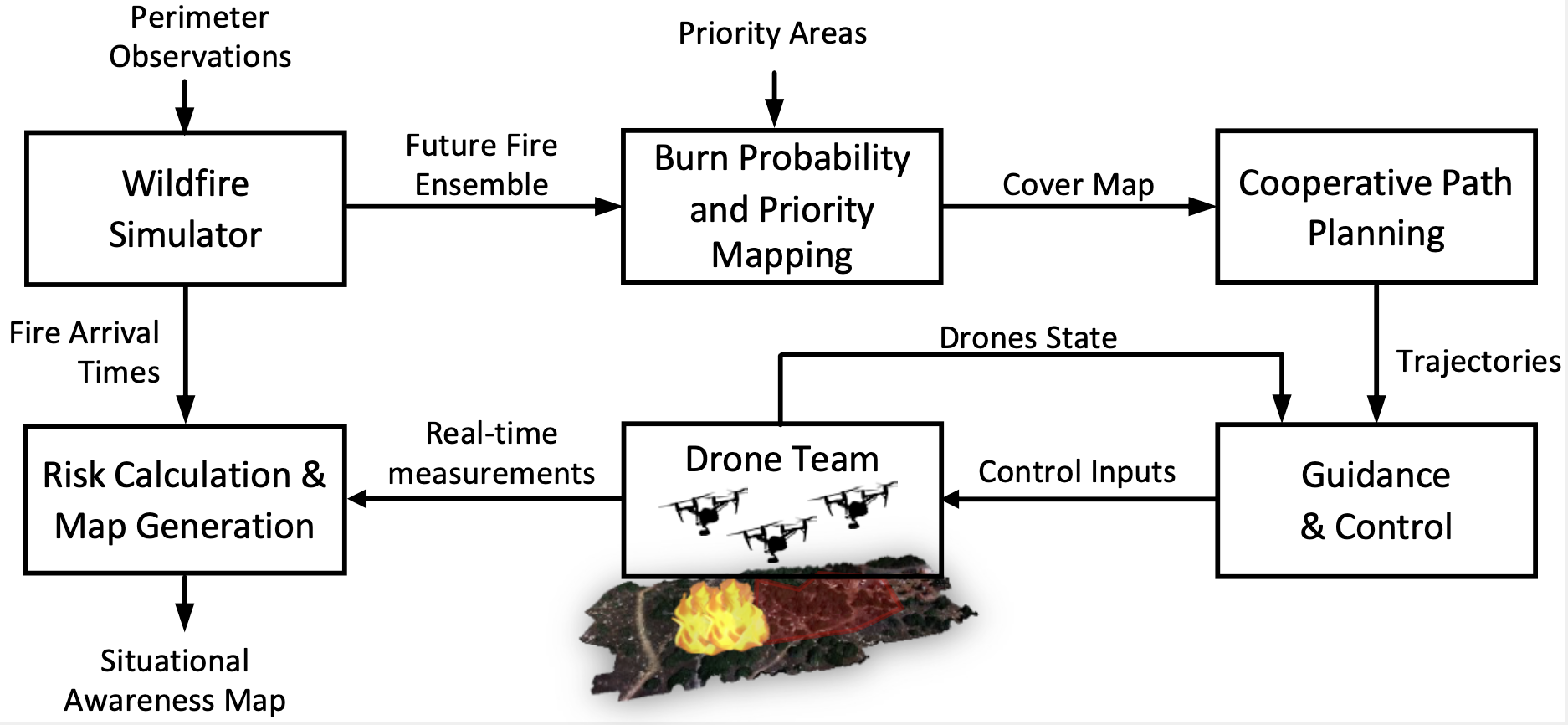
Effective situational awareness is crucial during wildfire emergencies to enhance the response capabilities and ensure the safety of the public and firefighting personnel. In this task, we introduce a novel method that employs autonomous drones for advanced scouting and mapping of critical elements such as people, vehicles, buildings, and infrastructure located ahead of advancing wildfires. Our approach leverages a wildfire simulator that predicts the future paths of wildfires. These predictions are used to calculate the burn probability across various regions. This predictive capability underpins a collaborative path-planning algorithm that strategically prioritizes and assigns areas for drone reconnaissance, ensuring efficient and targeted exploration. Additionally, we develop a real-time risk index that correlates the identified critical elements with their proximity to the wildfire front. This index provides actionable intelligence essential for facilitating timely evacuations and optimizing the deployment of firefighting resources. By focusing on critical interventions and formulating defensive strategies around high-value infrastructure and residential zones, our method promotes a more informed and proactive firefighting approach.
Key contributions of this research include:
a) A collaborative path-planning scheme enabling a team of drones to systematically search areas ahead of the fire, prioritizing based on strategic needs.
b) A real-time risk index that links the identified objects with their proximity to the wildfire front, enhancing decision-making processes.
Overall, this method significantly boosts situational awareness, enabling targeted evacuations based on real-time data about the fire’s path and the location of key objects. It also aids in the effective deployment of firefighting resources to protect critical infrastructure and residential areas.
The details of the proposed approach can be found in the references listed below.
References: