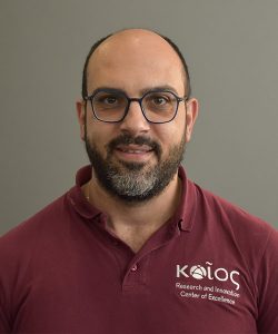
Andreas Georgiou received his Bachelor degree in “Environmental Sciences” (2008) and his M.Sc. on “Applied Geo-Informatics in Environmental & Risk Management” (2010), both from University of the Aegean at Greece. He worked as a Research Fellow at Cyprus University of Technology and at ENALIA Physis Environmental Research Centre where he involved in numerous European (LIFE) and national research programs at the field of GIS and thus spatial analysis, data analysis and visualization. His research interests and work focuses on object-oriented programming, the use of remote sensing and spatial statistics to understand and address environmental problems. He has been also involved in thematic cartography, modeling, data management and development of decision support systems.


